
Key Takeaways
- No Brisbane suburb is genuinely 100 percent flood-free, because flood risk is set at the address level, not the suburb level.
- Higher-lying, ridge-based suburbs generally carry lower river-flood risk, but many still have overland-flow and creek risk in specific pockets.
- Brisbane faces three main flood types: river flooding, creek and waterway flooding, and overland stormwater flow, each with its own map.
- The only reliable way to assess a property is an official flood report for the exact address, not a suburb reputation.
- A local buyers agent verifies flood risk for every property, protecting both your safety and your resale value.
After the 2011 and 2022 floods, flood safety has become one of the first questions Brisbane buyers ask, and rightly so. Flooding affects where you can live safely, what you will pay in insurance, and how well a property holds its value.
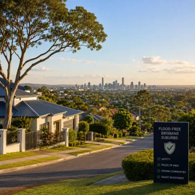
The phrase flood-free Brisbane suburbs gets searched constantly, but the honest answer is more nuanced than any simple list: no suburb is entirely immune, and even the highest suburbs contain low-lying pockets that flood.
What matters is understanding how flood risk actually works and how to verify it for a specific address. As an experienced Brisbane property market buyers agency, Amassed treats flood assessment as a core part of every purchase, and this guide shows you how to do the same.
This safety guide explains how flooding works in Brisbane, which suburbs and areas tend to carry lower risk, why elevation alone is not enough, how to check any address, and how professional representation protects you. If you would rather have that verification handled for you, our buyers agency service builds flood due diligence into every search.
Are There Any Truly Flood-Free Suburbs in Brisbane?
No, there is no Brisbane suburb that is guaranteed completely flood-free, and any agent who tells you otherwise is overselling. Flood risk is determined by a property’s elevation, its proximity to the river and creeks, and local stormwater patterns, all of which vary street by street.
What does exist are suburbs where a large share of the housing sits on higher ground, well away from the river and major creeks, giving them a lower overall flood profile. Even in these suburbs, though, individual low-lying blocks can carry real risk.
That is why a suburb reputation is only a starting point, and why every purchase across the wider Queensland property market still needs an address-level check against the official FloodCheck Queensland mapping.
How Does Flood Risk Work in Brisbane?
Brisbane faces several distinct types of flooding, and a property can be exposed to one, several, or none of them. Understanding the difference is the key to reading any flood map correctly.
River flooding comes from the Brisbane River breaking its banks, as it did catastrophically in 2011 and 2022, affecting riverside and low-lying suburbs. Creek flooding affects properties near waterways such as Enoggera Creek, Kedron Brook, Norman Creek, Bulimba Creek, and Oxley Creek. Overland flow is stormwater running across the ground during heavy rain, which can affect properties nowhere near a river or creek.
The Brisbane City Council maps all three through its FloodWise property reports, and the Bureau of Meteorology provides the rainfall and flood-warning context behind them. A property can sit high above the river yet still flood from overland flow, so all three must be checked.
There is also a fourth consideration for properties towards Moreton Bay and the tidal reaches of the river, where storm tide and tidal inundation can combine with heavy rain to raise flood levels. These different flood types do not always overlap on the same map, which is why a property can appear safe on one measure and exposed on another.
The lesson for buyers is that flooding is not a single yes-or-no answer but a layered picture, and each layer needs to be read for the specific block. Treating the 2011 and 2022 events as the only benchmark is also a mistake, because a property can flood in smaller, more frequent events that never make the news, and it is those recurring events that shape insurance and liveability year to year.
Which Brisbane Suburbs Are Generally Lower Flood Risk?
The suburbs with the lowest overall flood risk are generally the elevated, ridge-based areas set well back from the river and major creeks. These tend to sit across Brisbane’s hilly western, northern, and south-eastern arcs.
In the inner and western ridges, elevated suburbs such as Bardon, parts of Paddington, Chapel Hill, and Kenmore Hills sit high, though their creek flats can flood. Across the north, higher-lying suburbs like McDowall, Bridgeman Downs, Aspley, Everton Hills, and Ferny Hills carry lower river risk. In the south and south-east, elevated suburbs including Mount Gravatt, Holland Park, Carina Heights, Camp Hill, Carindale, Mansfield, and Wishart generally sit above the main flood zones.
Our guide to Brisbane growth suburbs and to finding your ideal Brisbane home covers many of these areas, but treat every name here as a starting point, never a guarantee, because each contains low-lying pockets that behave very differently.
Why Elevation Alone Is Not Enough
A high suburb does not mean a safe address, because overland flow and local creeks can flood pockets within even the most elevated suburbs. This is the single most common mistake Brisbane buyers make.
Many elevated suburbs are built around gullies, drainage lines, and small creeks that channel stormwater during heavy rain, and a home at the bottom of a slope can flood while the house at the top stays dry.
Overland flow in particular catches buyers by surprise, because it can affect a property that has never been near the river. Elevation is a useful signal, but it is no substitute for reading the actual flood maps for the exact block, including the overland-flow layer that many buyers overlook entirely.
It is also worth looking at how a property sits within its street, not just its suburb. Two homes a few doors apart can have very different risk profiles depending on their ground level, the height of the habitable floor, whether the block slopes towards or away from a drainage line, and how the local stormwater system performs under load.
Older homes built low to the ground can be more exposed than newer homes raised on higher slabs or built up to a defined flood level. Reading the contours of the immediate street, and asking how water moves through the area in a heavy downpour, tells you far more than the suburb name ever will. This is exactly the kind of ground-level detail that separates a confident purchase from an expensive assumption.
How Do You Check if a Brisbane Property Floods?
The reliable way to check flood risk is to pull the official flood reports for the specific address before you buy, not to rely on the suburb’s reputation or the agent’s reassurance. Two free tools make this straightforward.
Brisbane City Council’s FloodWise property reports show a property’s likelihood of river, creek, and overland flooding, while FloodCheck Queensland provides state-level historical and modelled flood mapping.
Order both for any property you are serious about, and read them alongside a full due diligence checklist that covers surveys, building and pest, and title. Our buyer services include ordering and interpreting these reports for every property we assess, so nothing is missed in the excitement of an inspection.
What Does a Flood Report Actually Tell You?
A flood report tells you the likelihood and potential depth of flooding at a property, which directly affects safety, insurance, and value. Learning to read one is a core buyer skill in Brisbane.
The reports show flood likelihood, often expressed as an annual chance or a defined flood level, and indicate which flood types apply to the site. That information feeds directly into insurance, and properties with meaningful flood exposure can attract far higher premiums or exclusions, as the Insurance Council of Australia explains.
A flood report will not make a decision for you, but it turns an invisible risk into a clear, comparable number you can weigh against price, insurance cost, and your own risk tolerance.
How Does Flood Risk Affect Property Value and Insurance?
Flood risk affects both what you will pay to insure a property and how easily you will sell it later, so it is a financial issue as much as a safety one. Buyers increasingly price flood exposure into their offers.
Properties with significant flood history or exposure can carry higher insurance premiums, harder resale, and more cautious lending, while genuinely low-risk homes increasingly attract a premium as buyers prioritise safety.
Independent CoreLogic home value data and median figures from the Real Estate Institute of Queensland help benchmark how flood-affected and flood-free properties trade in the same suburb. Factoring flood exposure into your offer, your insurance budget, and your long-term resale expectations is simply sound buying, not pessimism.
It is worth remembering that the buyer pool for a flood-affected home shrinks with every major weather event that stays in people’s memory, which can weigh on resale for years even between floods.
A home that is cheap today partly because of its flood exposure is often just as hard to sell tomorrow, so a discount at purchase does not always translate into a bargain over the long run.
Conversely, paying a little more for a genuinely lower-risk home can prove the smarter financial decision once insurance, peace of mind, and future resale are all taken into account. The right approach is to price the risk honestly and let the numbers, rather than hope, guide the offer.
How a Buyers Agent Protects You From Flood Risk
A buyers agent builds flood verification into every property assessment, so you never rely on a suburb’s reputation or an agent’s reassurance alone. In a city like Brisbane, that protection is worth far more than the fee.
A specialist orders and interprets the flood reports, checks elevation and overland-flow exposure, factors insurance costs into the true price, and walks away from properties that carry hidden risk. You can see the outcomes we have delivered in our client results, and the best way to start is a focused strategy consultation that maps your budget and risk tolerance to genuinely suitable, lower-risk homes.
Frequently Asked Questions
Which Brisbane suburbs are least likely to flood?
Elevated, ridge-based suburbs set back from the river and major creeks generally carry the lowest flood risk, including areas like Bardon, McDowall, Aspley, Mount Gravatt, Carindale, and Wishart. However, every one of these contains low-lying pockets that can flood, so a suburb reputation is only a starting point, never a guarantee for a specific address.
Is any Brisbane suburb completely flood-free?
No. No Brisbane suburb is entirely flood-free, because flood risk is set by a property’s elevation, drainage, and proximity to water at the address level. Even the highest suburbs have pockets exposed to overland stormwater flow or local creeks, so the only reliable measure is an official flood report for the exact property.
How do I check if a Brisbane property floods?
Order Brisbane City Council’s free FloodWise property report and check the FloodCheck Queensland mapping for the exact address. These show river, creek, and overland-flow risk. Always do this before making an offer, and read the reports alongside a full due diligence process rather than relying on the suburb’s general reputation.
Does flood risk increase insurance costs in Brisbane?
Yes. Properties with meaningful flood exposure can attract significantly higher insurance premiums, and in some cases flood cover can be limited or excluded. This is why flood risk should be factored into the true cost of a property, not just its purchase price, and why a flood report is essential before you commit.
What is overland flow flooding?
Overland flow is stormwater running across the ground during heavy rain before it reaches a drain, creek, or river. It can affect properties nowhere near a waterway, including homes in elevated suburbs. Because it surprises so many buyers, checking the overland-flow layer of a flood report is just as important as checking river and creek risk.
Should I use a buyers agent to avoid flood-prone properties?
For most buyers, yes. A local buyers agent orders and interprets flood reports for every property, checks overland-flow and creek exposure, and factors insurance into the true price. This protects both your safety and your resale value, and often prevents a costly mistake that far outweighs the cost of the service.
Buying a Safer Home in Brisbane
The safest Brisbane purchase is not about chasing a flood-free suburb name, but about verifying flood risk for the exact address and buying with clear eyes on safety, insurance, and value. Higher-lying suburbs are a sensible starting point, but the flood reports for the individual block are what actually protect you.
If you want that verification handled by specialists who assess flood risk on every property, the team at Amassed can help you find a genuinely lower-risk home and negotiate well. Get in touch through our contact page to start the conversation.
Resources
- Brisbane City Council: free FloodWise property reports showing river, creek, and overland flood risk by address.
- FloodCheck Queensland: official state flood mapping and historical flood information.
- Bureau of Meteorology: rainfall data and flood warnings for the Brisbane region.
- Insurance Council of Australia: guidance on flood insurance and how risk affects premiums.
- CoreLogic Australia: home value data to benchmark flood-affected and lower-risk properties.
- Real Estate Institute of Queensland: median price and market data across Brisbane suburbs.

Elijah Turkovic is the founder of Amassed, a licensed buyer’s agent in Queensland (licence QPBL 4617660) and a member of the REIQ. He has spent more than 10 years in property, development and real estate, and lives in Broadbeach Waters on the Gold Coast.
He leads the team’s searches, due diligence and negotiations on home and investment purchases across Brisbane, the Gold Coast and the Sunshine Coast. Amassed acts only for buyers and takes no commissions, referral fees or kickbacks from sellers, agents or the inspectors it recommends.